

The missing MH370 helped push intelligent mapping applications beyond the realm of possibilities.
Search results for "MH370"

Geoscience Australia awarded for bathymetric survey in MH370 search
710,000 square km of surveyed seafloor and the most detailed subsea topographic maps created.

MH370 search reveals 19th century shipwrecks
As the clock ticks on Ocean Infinity’s MH370 search, new analysis of survey data reveals historic discoveries.

MH370: conspiracy theories swirl as search vessel goes dark
Seabed Constructor disappears from AIS, agitating followers of search and relatives of those on board MH370.

Stakes raised: 90 days to locate MH370
A fee of up to $70m will be awarded for successful location — or zero if not.
MH370 search vessel to seek Australia’s first submarine
Fugro Equator to seek lost WWI sub, HMAS AE1.

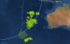
MH370: view the data behind the largest search in aviation history
The search for missing flight MH370 is a famously ongoing saga, and a story best told with maps.

Pressure mounts for a new MH370 search area
Growing evidence suggests the MH370 search has been in the wrong place.

The search for MH370 ends: what we learnt and where to now
As the search for MH370 ends, spatial data offers some final clues.

New MH370 search areas to be mapped with drift modelling
Vague government tender calls for “Drift Modelling and Search and Rescue System” in Indian Ocean.


