


Users are now able to combine several Digital Earth Australia datasets with Google Earth Engine’s own data.
Search results for "google"

NGIS and Google Earth Engine work on digital twin
The project explores ways of working with health data to produce environmental and health indicators.

NGIS receives Google sustainability award
NGIS has been named the global Google Cloud Industry Solution Partner of the Year for sustainability.
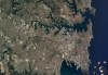
Google Timelapse reveals 37 years of change
The online tool uses 24 million satellite images to reveal how our planet has evolved over four decades.

Webinar outlines Hexagon x Google Maps integration
Join us tomorrow to understand the new capabilities of Hexagon Geospatial x Google Maps.

Spatial Source Webinar: Navigating to Business Success with Google Maps Platform
When:
15 October, 2020 @ 11:00 am – 12:00 pm
Where:
Webinar
Google Maps. Everyone uses it, but do you know that Google Maps is also a powerful tool for transforming your business in the time of COVID-19? With Google Maps Platform, you can leverage the strengths[…]

New webinar on leveraging the Google Maps platform
Join us in a free webinar 15 Oct. looking at how businesses can use the tools of Google Maps Platform

Nexar takes on Google Street View with Live Map
Nexar launches interactive map platform from dash cam imagery and metadata.

UNSW harnesses Google and NASA data for ecosystem mapping app
REMAP enables simple and swift analysis of Landsat data for ecosystem monitoring.

MapD brings GPU-powered analytics to Google Cloud launcher
Big data analytics platform MapD now leverages Google Cloud Platform muscle.


