

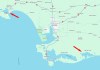
The campaign will produce detailed 3D maps of the seafloor and coastline between Riverton and Waituna Lagoon.
Search results for "lidar"
LiDAR shows Pacific cities are older than once thought
LiDAR has helped to show that city structures were being built 700 years earlier than previously thought.

Multispectral LiDAR
The IRIDESENSE 3D multispectral LiDAR sensor can analysing plant health and soil humidity levels remotely in real-time.

Real-time LiDAR mapping system
The Brumby LiDAR rapidly produces point clouds by removing the typically arduous post-processing workflow.
LiDAR leads to locating Roman roads
Data from the UK’s National LiDAR Programme has shown that not all Roman roads led to obvious destinations.

Victoria’s alpine regions LiDAR scanned for 1m DEM
Aerial LiDAR has been used to generate a 1-metre DEM of parts of Victoria’s Alpine and Mt Buffalo National Parks.

LiDAR lights the way for amphibious landings
The Royal Australian Navy has trialled a LiDAR-equipped camcopter for mapping seabed and beach areas.

Marine LiDAR sensor for USV
Teledyne Geospatial CL-360 marine LiDAR sensor that can be integrated with high-resolution multibeam systems.
Photogrammetry and Lidar. Complimentary Mapping Technologies
With the advent of drones and their flight limitations, photogrammetry and lidar are being combined more frequently into a hybrid mapping solution. If merged correctly, these two technologies bring complementary advantages.

LiDAR survey of New Zealand’s Taranaki region
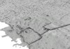
A ground-breaking aerial LiDAR survey has produced a wealth of valuable land-surface and elevation data.


