The launch of a new Location INformation Knowledge Platform (or LINK for short) delivers an exciting new era of open access to essential spatial datasets across all levels of government and Australia’s different states and territories.
LINK was announced last week at the Locate17 and Digital Earth Symposium held in Sydney, and creates simplified access to a wealth of fundamental spatial datasets. Before the advent of LINK, access to these data could only occur by conducting extensive searches across nine jurisdictions of Australia. All up, LINK incorporates datasets from no less than 73 agencies: 26 federal agencies; 40 state and territory-based agencies; 4 commercial agencies; and 3 non-jurisdictional agencies.
LINK is already up and running to deliver open public location datasets via cloud services to all users. It takes the conceptual Foundation Spatial Data Framework (FSDF), first published in 2012, and delivers a comprehensive online knowledge base.
Linking information to location is fundamental to making informed decisions.” – Angus Taylor, Australia’s Assistant Minister for Cities and Digital Transformation.

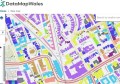
The extensive range of FSDF datasets already available via LINK help define locations and spatial extent of a range of data across ten broad themes:
- Geocoded Addressing
- Administrative Boundaries
- Positioning
- Place Names
- Land Parcel and Property
LINK was developed by Geoscience Australia, Australia and New Zealand’s Spatial Information Council, ANZLIC, and the Department of Prime Minister and Cabinet, together with Australia’s states and territories.
LINK is a significant step towards developing a truly national approach for spatial data information and marks a new era in open location information. This new data access service aims to support a range of applications including, but not limited to, agriculture, utilities, transport and emergency services.

Chief of Geoscience Australia’s Environmental Geoscience Division Dr Stuart Minchin explained that providing the FSDF datasets via one portal now ensures we can have a nationwide seamless exchange of spatial data.
“This makes these fundamental datasets far more discoverable and accessible, and contributes to the government’s broader vision of enabling the use of high value spatial data to assist in effective environmental, social and economic policy development,” Dr Minchin said.
“Users are able to discover trusted location information, learn more about governance and provenance of the data, and access a wide variety of location information data supplied by the Australian, state and territory governments,” he added.
The LINK provides detailed supply chain information and related metadata, including how the data is managed, where the products go and which agency is responsible for components within the supply chain. LINK will be automatically updated whenever datasets are updated by source agencies.

Angus Taylor explores spatial data in virtual reality at Locate16.
The launch of LINK coincided with last week’s Digital Earth & Locate 17 conference held in Sydney. Australia’s Assistant Minister for Cities and Digital Transformation, Angus Taylor, attended Locate in 2016 and this week delivered an official announcement of LINK to coincide with the conference.
“Linking information to location is fundamental to making informed decisions,” Assistant Minister Taylor said.
“Government entities hold a significant amount of location information which is a strategic national resource. Accurate location information is a key influencer of productivity, and will pave the way for new and innovative applications that increase efficiencies,” he said.
Among applications such as insurance, disaster management, and agriculture, Taylor highlighted the value of LINK for intelligent transport systems (ITS): “Having access to consistent and accurate position and road network data enables cooperative intelligent transport systems such as vehicle charging, and freight, logistics and container management,” he said.
“This allows for faster and more efficient supply of goods to market which is critical for the future of our smart cities and regional networks.”