Ahead of her appearance at the Locate Conference and Digital Earth Symposium in April, NSW Surveyor General Narelle Underwood shares some insights in an exclusive Q&A with Spatial Source.
Underwood was appointed in November 2016 as Australia’s first female Surveyor General, a major role within the state government responsible for leadership in surveying, mapping and geographic information. Her appointment makes Underwood both the first woman to hold the role across all Australian states, and the youngest in the state in 200 years.
As NSW’s 25th Surveyor General since 1787, Underwood is responsible for serving as President of the Board of Surveying and Spatial Information (BOSSI), chairing the Geographical Names Board of NSW; using location intelligence to better deliver urban planning, community services and infrastructure; acting as Electoral Boundaries Commissioner; and sharing knowledge and set standards at a national level with federal, state and territory counterparts.
Underwood spoke with Spatial Source to discuss the changing role of the surveyors, what we can expect at Locate and the under-representation of females in careers like surveying.
Spatial Source: How have you found the first three months in your new role as Surveyor General?
Narelle Underwood: Exciting and challenging. The creation of Spatial Services is a significant change in the operating of the land and spatial management systems of NSW which has changed the dynamic of the Surveyor General role. Spatial Services is a new entity within the Department of Finance, Services and Innovation and our core business is no longer just titling and registration, it is setting standards for the survey industry in NSW and creating economic and social value through leadership and innovation in the delivery of spatial data services. This has given us a new opportunity to create an organisation that services the government and public digital agenda and ushers in the future of surveying.
Through my involvement with our industry professional bodies and BOSSI I had an understanding of a significant portion of the responsibilities of the Surveyor General role so I was able to hit the ground running. I have spent my first 3 months strengthening relationships with my colleagues, staff and key stakeholders. I’ve concentrated on getting to know the finer aspects of the business and I’ve been to lots of industry events to talk to people about their ideas and concerns.
I’ve progressed the remake of the Surveying and Spatial Information Regulation, contributed to the development and implementation of GDA2020 and through the Geographical Names Board have begun development of an Indigenous Place Names Register.
What advice would you give to young women thinking of entering a career in STEM?
I’m going to steal the famous Nike tag line ‘Just do it’.
Our society is changing, particularly in the areas of technology and having a career in any aspect of STEM will open up so many opportunities for your career. STEM is not just the traditional laboratory or engineering roles anymore, it’s designing the next new life changing mobile app, or the way food is grown, processed and delivered. It’s developing better health care treatments and facilities. It’s delivering the transport and cities that we need for our changing population. A qualification in STEM will allow you to develop skills that will prepare you for a career that the world hasn’t even realised it needs yet.
What can we expect you and your fellow Surveyors General to be speaking about at Locate17?
There are a few opportunities for attendees to hear from the Surveyor Generals from the Australian states and territories. As part of the Land Surveying & Administration stream of the conference Craig Sandy (NT SG) will be talking about the Northern Territory Online Survey Approvals – linking planning, land titles and survey in a digital land development system, while I will be talking about Preservation of Survey Infrastructure. During this session there will also be a Surveyor Generals Panel – the intention is that conference delegates will be able to submit questions in advance and hear responses from each state/territory on the topics they want to hear about. Michael Giudici (Tas SG) will also be leading a plenary session on the implementation of the new national datum GDA2020.
What do you think about the representation of females in the Locate17 program?
There is a strong male bias in the surveying and geospatial professions, particularly in registered land surveyors (less than 3% of NSW registered land surveyors are female) and this bias can be seen in the program with the majority of speakers being male.
My experience with organising conferences and CPD events has shown that females are less likely to submit their work for presentation in a forum such as this, but the program for Locate17 features a number of key female presenters who are all considered industry leaders. Hopefully over the next few years we will continue to see an increase in the diversity of presenters but it is also important we have the right people talking about the right topics.
What are your priorities moving ahead in your role as Surveyor General?
- Finalisation of the Surveying and Spatial Information Regulation 2017 which should be out for public consultation in the first half of the year.
- Finalisation of the draft Surveyor General’s Direction 11 – Preservation of Survey Infrastructure. Launched at the ISNSW Australia Day Seminar it is open for feedback until Friday 31 March 2017.
- Review of Board of Surveying and Spatial Information (BOSSI) and development of a new strategic plan.
- NSW implementation of GDA2020.
- Promotion of adoption of LandXML and CadastreNSW to allow for a single, digital end-to-end cadastral process.
- Promotion of Surveying as a career option to high school students, increasing the gender diversity and increasing public understanding and awareness of the role of surveyors and geospatial professions in society.
How do you imagine the role of a surveyor will have changed five years from now?
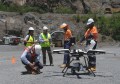
Technology is changing so rapidly that it is hard to imagine all the changes that the surveying and geospatial professions will face over the next five years. One thing that is definitely clear though is that access to spatial data is going to increase for everyone, not just surveyors. What does this mean for surveyors? As more people have access to data the role of surveyors as data managers will become extremely important. People won’t necessarily come to a surveyor to capture traditional detail or engineering survey data, the exponential growth of the RPAS/drone market is proof of that. The surveyor’s role will be to provide advice around accuracy and standards in order to make sure the data is fit for purpose. The merging of different data sets will continue to increase the importance for accurate metadata and connections to the Foundation Spatial Data Framework (FSDF).
Narelle Underwood will appear alongside fellow Surveyors General Michael Giudici and Craig Sandy at the Locate Conference and Digital Earth Symposium in April. The program has recently been released for what is shaping up to be one of the biggest spatial and surveying events to reach Australian shores.
Spanning four days from 3-6 April, the Digital Earth Symposium and Locate Conference will be held at the newly re-opened Sydney International Convention Centre.