

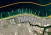
A new study highlights the accuracy of satellite-derived bathymetric datasets in coastal environments.
Search results for "satellite imagery"

Trial of in-orbit processing of satellite imagery
Computers developed by Australian firm Spiral Blue will be tested aboard Polish STORK satellites later this year.

Soaring Through Space and Time with Satellite Imagery
Planet designs, builds and operates the largest constellation of imaging satellites in history, collecting over 250 million square kilometres of imagery daily.
Read full story • Comments are closed

Arlula opens beta satellite imagery API
The Sydney-based satellite imagery startup has launched an open beta program for its Earth observation API.

Australian Defence signs $100 million deal for high-res satellite imagery
DigitalGlobe chosen to help deliver on the pledge to invest in satellite imagery.

The SpaceDataHighway for satellite imagery opens for traffic
New satellite communications send remotely sensed data at a rate of up to 40 terabytes a day.
Satellite Imagery Acquisition and Associated Services
The intention of this Invitation to Offer is to obtain one complete high resolution satellite imagery data coverage of the whole state on an annual basis and to obtain more frequent coverage over the Great Barrier Reef catchments. Aerial and Satellite Imagery is the key foundation dataset that supports nearly all information analysis and decision […]
Read full story • Comments are closed

Satellite Imagery of China’s disputed runway
China has completed the runway on Fiery Cross Reef in the South China Sea.

WorldView-3’s 30 cm satellite imagery now available to all
DigitalGlobe has announced the industry-first availability of 30 cm satellite imagery products.

Satellite imagery to protect Great Barrier Reef
Researchers are using satellite imagery to protect the Great Barrier Reef from polluted run-off.
