

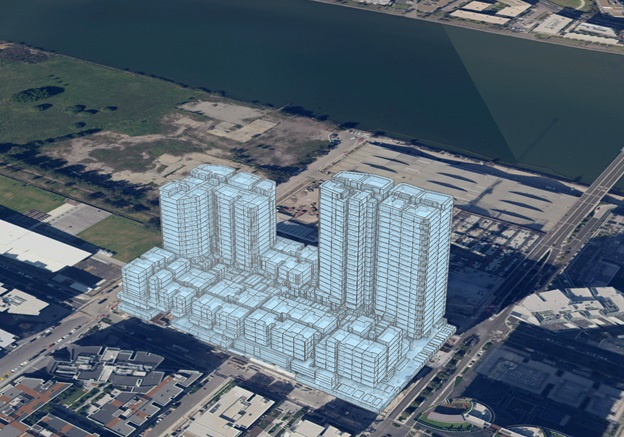
Image courtesy DCS Spatial Services
DCS Spatial Services has announced that the Cadastre NSW service has recently expanded services into 3D proposed data.
According to an update in Spatial Services’ most recent Insights newsletter, CadNSW users now have the option to receive a proposed 3D Strata Plan layer to complement the existing 2D layers, enabling councils to plan, assess and approve new developments with support from 3D platforms.
“The benefits of these proposed 3D inclusions range from shadow and solar modelling through to visualising impact on city skylines, mapping 3D addressing, predicting impacts on transport and service networks, and supporting virtual environmental impacts studies,” the update says.
“The Proposed 3D Strata Plan process borrows much of its data processing from the existing 3D Strata process that has been tested and refined over the Western Parklands City proof of concept area.
“CadNSW extends the proposed 3D Strata Plan capture to Development Application (DA) and Subdivision Certificate plans, applying assumed heights where necessary, and reprocessing plans as they progress through the development and assessment process — always returning the most current version of a project.
“The objective being to continuously provide an up-to-date and accurate 3D representation of proposed strata, in a real-world location and referenced to other geospatial datasets.”
Spatial Services says that as the world progresses toward “digital twins and 3D platforms, our 3D/4D capabilities will be continuously refined to reflect and contribute to industry standards. Practical applications of 3-dimensional data influence our development and product offerings.”
Stay up to date by getting stories like this delivered to your inbox.
Sign up to receive our free weekly Spatial Source newsletter.


