The 2024 edition of the International Conference on Geographical Information Systems Theory, Applications and Management (GISTAM 2024) aims to create a meeting point of researchers and practitioners that address new challenges in geo-spatial data sensing, observation, representation, processing, visualization, sharing and managing, in all aspects concerning both ICT as well as management information systems and knowledge-based systems.
The conference welcomes original papers of either practical or theoretical nature, presenting research or applications, of specialised or interdisciplinary nature, addressing any aspect of geographic information systems and technologies, such as:
- Data acquisition and processing
- Remote sensing
- Interaction with spatial-temporal information
- Spatial data mining
- Managing spatial data
- Modelling, representation and visualisation
- GIS and climate change
- Domain applications

The 4th International Symposium on Applied Geoinformatics (ISAG2024), which will take place at the Wroclaw University of Science and Technology, Wroclaw, Poland, on 9 and 10 May 2024. ISAG2024 is jointly organised by the Department of Geomatics Engineering, Yildiz Technical University, Istanbul, Türkiye, Wroclaw University of Science and Technology, Wroclaw, Poland and Technical University of Crete, Chania, Crete, Greece.
The aim of the 4th ISAG is to bring scientists, engineers and industry researchers together to exchange and share their experiences and research results and discuss the practical challenges encountered and the solutions adopted in geoinformatics.
Topics to be covered include recent advances in AI, satellite imagery, advanced remote sensing, photogrammetry, image processing, global navigation satellite systems, height systems, terrestrial laser scanning, GIS, smart cities and land management.

The 9th International Conference on Cartography and GIS will take place in Nessebar, Bulgaria from 16 to 21 June 2024. The ICCGIS is a biannual conference that began in 2006 and has been held every two years since (except for 2020). In total, the Conference has attracted attendees from more than 60 countries and has published more than 700 scientific papers in its proceedings.
The aim of the conference is to collect knowledge and share experiences about the latest achievements in the field of cartography and GIS. Multiple parallel events will take place during the conference, including annual meetings of ICA commissions and a special ISDE plenary session. There will also be a Seminar on Disaster Risk Reduction – Solutions and Innovations.

The Philippines will host the International Society for Photogrammetry and Remote Sensing (ISPRS) Technical Commission V (TC V) Symposium with the theme, ‘Insight to Foresight via Geospatial Technologies,’ from 6 to 8 August 2024 in Manila.
The three-day event will feature plenary and parallel sessions, exhibits, poster presentations and business meetings, and aims to inspire new methods of teaching/learning, collaboration, and promotion of accessible and easy-to-use geospatial data among engage professionals, educators and tertiary students.
ISPRS TC V focuses on the capacity building of professionals, educators and students, and in developing cost-effective teaching methods. These include distance learning programs, international collaborations on sharing web-based resources, and curricula development that meets regional needs.
- Deadline for submission of full papers for annals & abstracts for archives: 15 March 2024
- Notification of paper acceptance: 15 April 2024
- Early registration: 15 May 2024
Image credit: ©stock.adobe.com/au/Ungrim

The second Advancing Earth Observation Forum will be held at the Adelaide Convention Centre. The five-day event will attract delegates across a broad spectrum of applications, sensors and interests, including industry, research, defence, government, students and end-users.
The biennial Forum was created to enable the Earth observation (EO) community to communicate, coordinate, collaborate and collectively assess the state of EO in the Australian and Asia-Pacific region.
AEO24 will build on the momentum generated at the inaugural AEO Forum held in Brisbane in 2022, bringing together all sectors involved in EO to propel the sector forward to meet the growing international demand for EO.

The international photogrammetry and remote sensing community will gather in Perth in October 2024 for the mid-term symposium of the International Society for Photogrammetry and Remote Sensing (ISPRS) Technical Commission IV: Spatial Information Science.
The ISPRS is a non-governmental organisation devoted to the development of international cooperation for the advancement of photogrammetry and remote sensing and their applications.
The Geospatial Council of Australia is the Australian member of ISPRS, with Australia’s Professor Sisi Zlatanova appointed Chair of ISPRS Technical Commission IV.
The symposium will provide a forum for researchers and practitioners to come together and share their work and ideas, discuss opportunities and challenges, exchange developments or software tools, and discuss future directions.
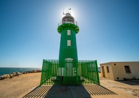
Image credit: ©stock.adobe.com/au/Luciano Raspa/Wirestock Creators

FOSS4G Perth is a local, community-driven gathering of the Perth open geospatial community, focused on sharing news of developments in free and open-source software for geospatial applications.
The event will be an opportunity to share ideas about open-source tools, such as QGIS, PostGIS, OpenStreetMap, Sentinel-2 satellite imagery, Python-based Earth observation libraries and frameworks, GDAL, and many others.
This year’s event will be held in conjunction with the ISPRS Technical Commission IV Symposium.
The 2024 FOSS4G Perth organising committee comprises:
- Bryan Boruff – University of Western Australia
- Cholena Smart – Mammoth Geospatial
- Grant Boxer – Consultant Geologist
- Ivana Ivanova – Curtin University
- John Bryant (Chair) – Mammoth Geospatial
- John Duncan – University of Western Australia
- John Lang – Consultant
- Keith Moss – WA Government
- Michel Nzikou – DMN Solutions
- Nimalika Fernando
- Petra Helmholz – Curtin University
- Piers Higgs – Gaia Resources
- Renee Manser
- Stafford Smith
- Tracey Cousens – Mineral Resources Limited
- Vincent Dinh – GIS Pro

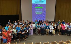
The 2024 Pacific Islands GIS & Remote Sensing Users Conference is reputably the largest GIS and remote sensing conference attended by Pacific Islanders, who leverage this annual opportunity to network and pursue partnerships with practitioners from around the globe.
The conference spotlights the latest innovative technologies, promotes knowledge and capacity development and sharing of best practices, and attracts a gathering of more than 300 attendees.
The theme for the 2024 event will be ‘Sustainable management of coastal areas through remote sensing and GIS.’


