

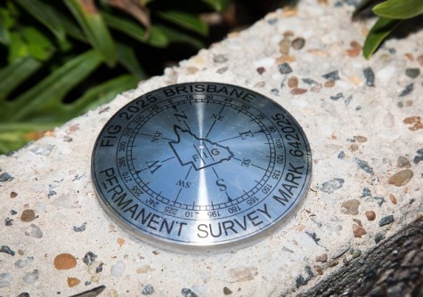
A special permanent survey mark has been installed in Brisbane to recognise the city as the host of the combined FIG Working Week and Locate25 conferences, currently underway.
The permanent survey mark (PSM) has been installed by the Queensland Government, near the start of the South Bank end of the Neville Bonner Bridge that spans the Brisbane River.
The PSM signifies the role played by surveying and spatial sciences in urban development, infrastructure projects and land management.
The PSM was officially unveiled by Steve Jacoby, Conference Convenor and Executive Director, Spatial Information | Georesources in the Queensland Department of Natural Resources and Mines, Manufacturing and Regional and Rural Development, and Diane Dumashie, FIG President.
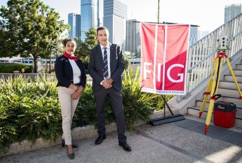
“This permanent survey mark not only recognises Brisbane’s role in hosting this globally significant conference but also serves as a lasting legacy of the critical work done by surveyors and spatial professionals,” said Jacoby.
“PSMs are fundamental to the alignment of spatial data with physical infrastructure, enabling accurate mapping, land surveys and large-scale construction projects.”
The unveiling of the PSM is “important for FIG… because it strengthens the partnership that we try to foster, not only in our [surveying] community, but also in the wider community,” said Dumashie, adding that “the legacy it leaves” also is important.
The commemorative PSM joins the more than 180,000 survey marks recorded in Queensland’s Survey Control Register, managed by the Department.
The Register is the official source of survey control data, documenting information such as horizontal and vertical location, administrative details and the condition of each mark.


