Digital Cadastre Modernisation (DCM) – Industry Information
The Department of Environment, Land, Water and Planning (DELWP) has two related procurement processes in May and July 2018.
- Request for Tender (RFT) 338298 for cadastral data back capture services was issued by DELWP on 28 May 2018.
- A related Expression of Interest (EOI) will be released for the remaining stages of the DCM, (adjustment, integration and automation phases) on or about 31 July 2018. Potential suppliers will be asked to register their interest and outline their capability to deliver and innovate across one or multiple stages. Further procurement steps are anticipated in 2019.
There are four inter-related stages of the DCM which are expected to go to market. This tender notice relates to the first stage – back capture (RFT process 338298).
DELWP is upgrading the spatial accuracy of the state’s digital representation of property boundaries (the authoritative digital cadastre) for the state’s 3.3 million properties. An upgraded digital cadastre will deliver significant quality and efficiency improvements for sectors including land development, surveying, planning, utilities, emergency services and infrastructure development. The DCM will deliver spatial accuracy of up to 0.1 metre for urban and 0.5 metres for rural land.
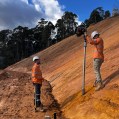
STAGE 1 – Back capture: This stage will accurately capture specified data from PDF copies of registered plans and cadastral surveys into digital format LandXML files. This stage will also include the capture of particular features from aerial imagery.
The Tender will seek proposals to deliver back capture services for the entire state. Key information relating to the Tender includes:
- The scope should be broken into a minimum of three packages (a maximum of 1.3m parcels in any package), and the initial contract will be for only the first package.
- Bidders should scope these packages in a manner which they believe will best meet DELWP’s objectives (around the most accurate and efficient delivery of the upgraded digital cadastre).
- Subject to satisfactory delivery of the first contract, the successful bidder may be contracted to deliver the remaining packages.
- Alternate proposals are encouraged, should bidders identify an opportunity to deliver better outcomes or innovation by combining the back capture stage with another DCM stage (outlined below).
Future procurement / future DCM stages (June EOI)
Three future stages of the DCM which will be outlined in the July EOI are briefly described below.
STAGE 2 – Adjustment: Initially, the analysis and validation of the back captured data obtained from stage 1 will be required. This will be followed by calculation and validation of the coordinates and uncertainties for all land parcel corners from back captured files and Victoria’s Survey Control Network. DELWP has bespoke software that may assist with the adjustment process, which can be licensed free of charge to the service provider.
STAGE 3 – Integration: Integrating the upgraded digital cadastre from STAGE 2 into the state’s authoritative map base (Vicmap™). Note that the DCM upgrade coincides with the next re-tender of the ongoing maintenance contract for Vicmap™, and it is possible there will be an opportunity for vendors to bid for both the integration stage and ongoing maintenance.
STAGE 4 – Automation: Enhancing DELWP’s existing corporate systems to fully automate the process of updating Victoria’s digital cadastre with new data (such as new sub-divisions) lodged in a digital format through SPEAR.
A fifth and essential aspect of the project relates to change management; this will run throughout delivery.
For further information please contact christopher.quinn@delwp.vic.gov.au, DCM Program Manager.