

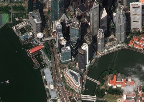
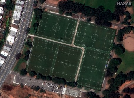
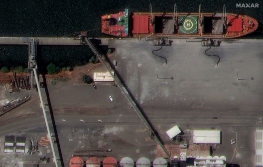
Maxar Intelligence has released initial images from the first two of its 30cm-capable WorldView Legion satellites, which were launched from Vandenberg Space Force Base, California on 2 May 2024.
The company says the images of urban and industrial spaces in California, Singapore, South Africa, Spain and Brazil, demonstrate the capabilities of the new satellites and highlight “the value of high-resolution satellite imagery for precision mapping, site monitoring, geospatial analytics and other important use cases”.


“Soon, our WorldView Legion satellites will be collecting vast amounts of imagery, extending our collection capacity advantage for high-resolution imagery and enhancing the revisit rate of our industry-leading constellation,” said Dan Smoot, CEO of Maxar Intelligence.
“This added capacity will also strengthen our geospatial foundation, helping us build more sophisticated products that unlock the full potential of geospatial data and generate more actionable insights in 2D and 3D.”
Maxar plans to launch six of the WorldView Legion satellites which, it says, will triple its capacity to collect 30 cm-class imagery and enable dawn-to-dusk collection as frequently as every 20 to 30 minutes.
The company expects to launch all six of the satellites by the end of 2024.


