

Image credit: ©stock.adobe.com/au/artiemedvedev
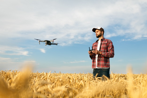
Farmers across NSW are benefiting from free drone training, helping them apply new technologies to make life on the land more productive and prosperous.
Minister for Skills Training, Alister Henskens, said the in-demand training is helping primary producers reap the benefits of new and emerging technologies.
“This practical, hands-on training explores the application of drones to a range of agricultural pursuits, so every farmer who participates will know how a drone can benefit their farm planning and day-to-day practices,” Minister Henskens said.
“The course will give farmers the confidence and technical skills to operate a drone safely and legally, and ultimately, improve how they do business.”
More than 580 people have taken up $878,000 worth of free training, which comprises an online training session followed by a one-day on-farm workshop.
New course dates have been released, with farmers encouraged to enrol in upcoming courses at the following locations:
- Hillston – Monday, 23 May
- Balranald – Tuesday, 24 May
- Dareton – Wednesday, 25 May
- Warialda – Monday, 6 June
- Gunnedah – Tuesday 7 June
- Scone – Wednesday, 8 June
- Coolah – Thursday, 9 June
Minister for Agriculture and Western NSW, Dugald Saunders, said the free courses are being funded by the NSW Government under its AgSkilled 2.0 program.
“Technology continues to revolutionise how farmers operate, and courses like this one are an opportunity for people to upskill using the latest technological advancements,” said Minister Saunders.
“The agriculture sector is stronger than ever, despite a challenging few years of fires, floods and drought. It’s important that we continue to roll out programs like these so our farmers can strengthen and grow their operations during this prosperous time.”
Stay up to date by getting stories like this delivered to your inbox.
Sign up to receive our free weekly Spatial Source newsletter.


