

 The Conversation
The Conversation has produced this stunning map telling the story of destruction and recovery of Australia’s 2019/2020 bushfires.
NASA Maps the Damage from the Beirut Explosion
 The Map Room
NASA has released a map of the likely extent of damage from the explosion in Beirut.
Morgan Herlocker to GeoHipster: “Look for similar work with a different label”
 Geohipster
Morgan Herlocker is an open source software developer and creator of the Turf distributed geospatial analysis framework. He has worked on mapping and statistics software across the geo industry, from consumer navigation to citizen counter-surveillance. Morgan has been a vocal advocate for user privacy in the design of location telemetry systems. He sits down with Mike Dolbow for GeoHipster.
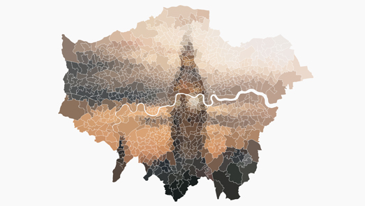 Maps Mania
Keir Clarke muses on the artisitci side of chloropleth visualisations, uncovering a seam of creative talent working in an unlikely medium.
The Origins of the Stonehenge Stones
 Map of the week
Where the stones that make up Stonehenge’s megaliths came from has long been a subject of curiosity and debate. These stones do not exist in the immediate vicinity and needed to be transported from a significant distance. A new article in Science Advances traces their origins using “geochemical” analysis.
Stay up to date by getting stories like this delivered to your mailbox.
Sign up to receive our free weekly Spatial Source newsletter.


