

How the 50 Words project is using technology to bring language to the world
 NITV
NITV
As NAIDOC week draws to a close, NITV highlights a first-of-its-kind digital research project bringing Australian Indigenous languages to the world through an interactive map-based interface.
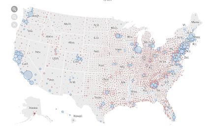 Map of the week
The always-on MOTW blog showcases some stellar US election maps.
COVID-19 is Showing How Smart Cities Protect Citizens
 Spatially Adjusted
James Fee on Covid-19 and the impacts of smart cities technologies on public health.
Anton Thomas’s Next Project: Wild World
 The Map Room
Here’s what Anton Thomas, whose pictorial map of North America was released earlier this year, is working on now: Wild World, a pictorial map of the natural world.
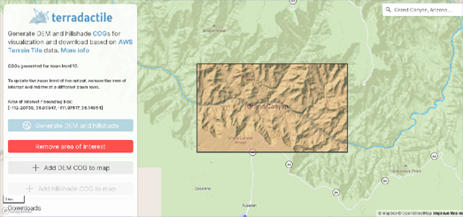
Maps Mania
Terradactile is an interactive map which can be used for generating and downloading hillshade and Digital Elevation Model data for any area of the Earth.
Stay up to date by getting stories like this delivered to your mailbox.
Sign up to receive our free weekly Spatial Source newsletter.


