

Image courtesy DCS Spatial Services
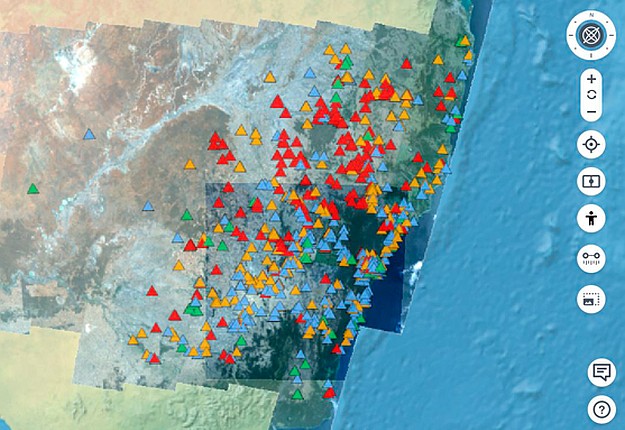
DCS Spatial Services has worked with the NSW Department of Primary Industries (DPI) and CSIRO’s Data61 to bring mouse plague data into the NSW Spatial Digital Twin (SDT).
Mouse numbers and sighting locations are reported by landholders across the state through the MouseAlert app and via the website https://www.feralscan.org.au/mousealert/.
It is hoped the widely available will encourages more community contribution, in turn raising the profile of the app and the quality of the data.
According to the CSIRO, the user-driven, crowd-sourced data is quite an accurate indicator of the extent of mouse activity.
Complementary datasets of interest for mouse plague indicators include soil moisture, crop species and wind, all of which provide valuable information for landholders, industry and government in their efforts to manage and control plague numbers.
Although the data has scientific limitations due to the nature of how contributions are made and the generalised way in which numbers are quantified, plans are afoot to use sensor technology to monitor mouse plague activity in the future.
Activity rather than mouse numbers are being targeted in this development, which will leverage wireless technology that the agricultural industry is increasingly using to monitor localised weather conditions and soil moisture.
Landholders who contribute their data to MouseAlert are connected to a suite of resources such as support packages from DPI, as well as Grains Research and Development Corporation videos and mouse plague information.
The data can be found on the NSW Spatial Digital Twin’s website (https://nsw.digitaltwin.terria.io/). Select Explore Map Data from the top left hand side option, choose Live Data, then NSW Mouse Alert in the drop down list.
Stay up to date by getting stories like this delivered to your inbox.
Sign up to receive our free weekly Spatial Source newsletter.


