

Image credit: ©stock.adobe.com/au/syahrir
The Group on Earth Observations (GEO) has joined the Risk-informed Early Action Partnership (REAP) to help ensure that 1 billion people are safer from disasters by 2025, by harnessing Earth observation (EO) data and tools.
GEO is an intergovernmental partnership connecting multiple different stakeholders globally, using open knowledge based on EO to address environmental and socioeconomic challenges.
The GEO community will contribute to the work of REAP by providing practical examples from the GEO work program using EO data, tools, services and methodologies to make science-based decisions on anticipatory action.
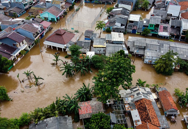
The GEOGloWS Global Streamflow Forecasting Service provides local stakeholders with water information to address pressing water management issues, such as streamflow forecasting and flooding.
Another early warning tool that highlights the value of EO data to increase resilience is the Crop Monitor for Early Warning (CM4EW) an initiative of the Group on Earth Observations Global Agricultural Monitoring Initiative (GEOGLAM).
CM4EW provides science-based and actionable information on current crop conditions to better assist governments and humanitarian organisations in addressing food insecurity.
Early warning of crop failures or other extreme weather events, such as droughts, enables governments and other stakeholders to initiate appropriate disaster response mechanisms to avoid negative socioeconomic and societal impacts.
To help governments integrate anticipatory measures using EO-based evidence, GEO will also provide the REAP community with policy recommendations and practical guidance on how to leverage EO for early warning and early action.
GEO will also share good practice and act as a link to marginalised and underrepresented communities through the GEO Indigenous Alliance, a global network of Indigenous leaders and practitioners dedicated to promoting access to and the use of EO data to enable early action.
Since 2016, Disaster Risk Reduction and the Sendai Framework have been a key global focus area for GEO, and this partnership demonstrates that commitment. By participating in REAP, the GEO community will be able to align REAP donor activities with GEO resource mobilisation requirements, strengthening the collective capacity to act in advance of disasters.
Stay up to date by getting stories like this delivered to your inbox.
Sign up to receive our free weekly Spatial Source newsletter.


