

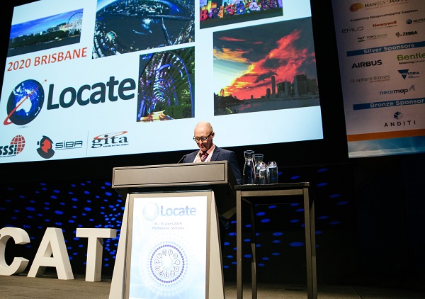
Locate20 Convenor Paul Reed addresses the crowd at last year’s conference.
In anticipation of the upcoming Locate20 Conference and Exhibition at the Brisbane Convention and Exhibition Centre on 28-30 April 2020, Position magazine spoke to Locate20 Convenor and SSSI Queensland chairman Paul Reed about the challenges the industry is facing, the new opportunities it looks forward to and the topics Locate20 will cover.
Position: Geospatial and location technologies are evolving, changing at an ever-increasing rate. How are the organisers of next year’s Locate working to address those changes and making sure that the event is on the cutting edge of the industry?
PR: The organisers of Locate recognise the importance of bringing the latest spatial innovations and news of inspiring challenges and successes. As such we reach out and engage with the key players from within our industry who may be involved in research and development as well as people who are also leaders in applying these new technologies and ideas to improve the way in which they capture, process and present data. Geospatial technology is being adapted and integrated into so many tools that are being used across industries such as mining construction and agriculture. As a result, we are making efforts to reach out to other areas of the economy outside of our industry to learn how they are evolving as they begin to utilise and benefit from spatial technologies.

Attendees will again get the chance to collaborate at the popular Hub sessions first introduced at Locate19.
Position: Next year’s conference theme is “Convergence, collaboration and community – Towards a stronger economy”. What are some of the ways that companies and other players within our industry are making an impact on pushing our economy forward? What more needs to be done?
PR: On a larger scale we have already begun to see how geospatial capabilities have positively influenced the agricultural industry, employing Global Navigational Satellite Systems (GNSS) along with automation of machinery and analysis of satellite imagery are transforming farms across the world. Similarly, we have seen the mining industry harness the power of scanners UAV, drones and GNSS systems to improve the productivity and accuracy of mining operations.
We are beginning to now see the implementation of these technologies in smaller companies providing increased capabilities and the ability to capture and process much greater amounts of data than ever before. What is needed is to allow further convergence across different areas of technology such as the areas of Artificial Intelligence (AI) and Machine Learning (ML).
Locate seeks to provide a platform that inspires people to collaborate, learning from each other and the way we can improve our businesses and better manage projects.
Position: Technologies such as 3D scanning and building modelling have enabled increased use of digital town planning techniques, to the level where large projects are mandated by governments to use BIM from the early planning phases. How has BIM evolved to such widespread use?
PR: Building Information Modelling (BIM) benefits government and industry by boosting innovation, productivity and competitiveness in the construction industry. The adoption of BIM is increasing worldwide as the construction industry is becoming largely aware of the benefits it offers. The UK, Singapore, USA and Europe have adopted and implemented BIM, which was identified as a key technology to building smart cities.
The BIM initiative in Australia is highly infrastructure-driven, with transport and infrastructure bodies coining the term ‘digital engineering’. Queensland is leading the way with its coordinated approach following the release of the Digital Enablement for Queensland Infrastructure.
BIM is already being used on major projects, including Cross River Rail. Since 1 July 2019, all Queensland Government construction projects with a value of $50 million or more are required to use BIM from the early planning phase. All major government infrastructure projects will transition to implement BIM by 2023.
Industry has reacted positively to these demands with more and more businesses gradually adopting the technology, however, industry organisations and government bodies are still coming to terms with the regulations that need to be established for accuracy standards and connection to cadastral boundaries.
It is exciting to see the benefits to industry in terms of reduced cost, time and efficiency that the adoption of BIM brings to construction projects. In time we see BIM techniques replacing or complementing many of the traditional methods of construction.
Position: Governments not only mandate the use of spatial technologies but, in many cases, also control the standards and reference data. For example, Australia is in the process of upgrading its geocentric datum to GDA2020, to replace GDA94 as the current datum. How is this progressing and what will the industry have to look out for?
PR: The Australian Government is committed to providing greater positional accuracy to anyone in Australia in the near future. There has been anticipated growth in the reliance on handheld navigational devices and as a result, the government has realised the need to upgrade Australia’s Datum to GDA2020. This upgrade is well underway and ANZLIC – the Spatial Information Council – has locked in 30 June 2020 as the date by which they will deliver GDA2020. GDA2020 is actually already available for use now.
What this means for industry practitioners is that they will need to be aware of the change and implement strategies in their working environments to accommodate the change as seamlessly as possible. When working between different datums they will need to apply transformations to the coordinates to bring into the same datum. This will require data captured on GDA94 coordinates to be transformed to bring it into line with data on GDA2020 coordinates.
Position: Who is in charge and how do you expect the implementation of GDA2020 to proceed?
PR: The Intergovernmental Committee on Surveying and Mapping (ICSM) was established by the prime minister, state premiers, and the chief minister of the Northern Territory in 1988. Since that time, the Australian Capital Territory and New Zealand have joined ICSM.
The Australian Defence Forces are also represented on ICSM.
The Intergovernmental Committee on Surveying and Mapping, the Permanent Committee on Geodesy and the GDA Modernisation Implementation Working Group are all working with the Australian Government and its agencies to bring about the implementation of GDA2020.
The implementation of GDA2020 commenced in 2018. Transformation products and tools (GDA94 ⇔ GDA2020) and supporting documentation have been made available via the ICSM and relevant jurisdiction websites.
Position: Another upcoming technology gaining widespread acceptance is digital twins. Can you describe the technology and how and where it is used?
PR: Digital twins are a realistic digital representation of physical things. What distinguishes a digital twin from any other digital model is its relationship to the physical twin. A digital twin model will be able to be used as a decision-making tool that can help manage assets from bridges to tunnels and underground service networks to high rise buildings. The digital twin can be dynamic using live data flows from sensors giving feedback to allow better control of the physical twin. AI and cyber physical systems are using this to test robotics. Twins can also be static models being fed data from the physical twin to provide a means for better corporate management of the physical twin. This is now being used in major projects for the long-term management of infrastructure and buildings.
Position: With the advanced use of technology in all aspects of the industry, it not only creates and manages but also uses vast amounts of data. As a response, data is being made more readily available by government agencies and others, under the umbrella-term open-source data. How does the industry take advantage of this facility?
PR: Data is critical in the management and planning of our cities and regions. Government agencies are able to make better informed decisions when the data is made more accessible. GIS mapping forms the framework which underpins much of this data. This creates opportunities for collectors of accurate data and GIS professionals to collect accurate data and become the gate keepers of this geographic framework. The spatial industry will be responsible to provide and update these maps and resources that the government use. The industry and other users of open source data will in turn benefit from this through reduced costs and the promotion of progress and innovation. It also allows for community engagement and feedback and preserves information over time.
Position: Locate conferences are used by many practitioners to keep up to date and further their industry knowledge, hoping to gain useful, practical, informative learnings. What do you hope attendees will gain from this year’s conference, Locate20?
PR: Locate is a conference that provides opportunities to learn about and review some of the latest developments in the industry. It is at conferences such as these that we can network with colleagues and gain a broader understanding of the roles of other professionals in our industry. At the conference we can discuss issues we are facing and act as an advocate for our industry bodies and their professionals. Overall, we aim to provide value for everyone within the surveying and geospatial community.
This year we are hoping to engage with spatial professionals from across a wider range of the industries and to connect with and include spatial communities that are not only involved in the industry but share the excitement of where our industry is heading.
In addition to his roles with SSSI and Locate20, Mr Reed is director of East Coast Surveys based in Brisbane.
Attendees have until January 31 to take advantage of Early Bird pricing for Locate20 – for more information, go to www.locateconference.com/2020


