

A new online tool that identifies areas at risk from groundwater flooding has been developed by New Zealand scientists.
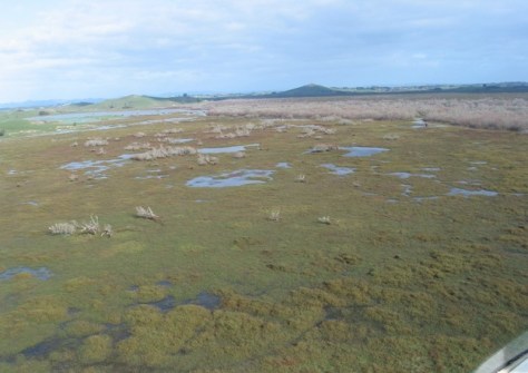
Groundwater flooding occurs when the water table rises close to the surface, causing issues even before the water visibly floods the ground.
The Shallow Groundwater Screening Tool, which identifies areas at threat from water table rises, will help hazard and land-use decision-makers understand the scale of the problem and identify which areas are likely to be the most vulnerable.
Groundwater flooding is often overlooked as a threat, however it is a hazard that traditional flood defences such as stopbanks and seawalls cannot contain because the water comes up from underneath.
When the groundwater rises, it can saturate soil and structures, weaken infrastructure, increase liquefaction risk and worsen surface flooding from heavy rainfall.
The first-of-its-kind online tool, developed as part of the NIWA-led Future Coasts Aotearoa research programme, shows areas that could be exposed to shallow groundwater hazards, right now, based on existing groundwater measurements, says the lead for the Future Coasts Aotearoa programme, NIWA Chief Scientist Coasts and Estuaries Dr Scott Stephens.
“Increased flooding events will be a real driver of change in many places,” he said.
“Rising groundwater will destabilise roads and damage buildings. It could make farming uneconomic. Stormwater pipes will be persistently full.
“Councils and decision-makers need an accurate picture of current shallow groundwater levels to prepare for future risks by identifying what areas could be exposed to shallow groundwater as sea levels continue to rise.
“This tool will be useful for local, district and regional councils, engineers, infrastructure providers, and rural communities, as well as individual citizens who want to make better-informed decisions for their future.”
Water resource consultancy Kōmanawa Solutions created the tool. According to its founder, Zeb Etheridge, the shallow water table is the part of the groundwater system that’s most affected by sea level rise.
“Two-thirds of New Zealanders live in coastal areas, meaning much of our infrastructure and land use falls within these vulnerable zones,” he said. “Understanding this issue is critical for future planning.”
The Kōmanawa Solutions team pulled together 2.4 million real-life readings of groundwater depth from around the country. To fill in the gaps, they used machine learning trained on factors that influence the water table, such as land elevation, soil type and nearness to waterways.
“Local authorities are likely to undertake more detailed assessments of the areas that are shown to be potentially exposed before making any significant decisions,” Etheridge said.
The tool is designed so that the certainty of detecting risky groundwater levels can be dialled up or down, as can the depth of groundwater that is of interest.


