

RMIT University scientists have developed a new technique for spotting plastic rubbish on beaches and successfully field tested it on a remote stretch of coastline.
The satellite imagery tool picks up differences in how sand, water and plastics reflect light.
Although satellite technology is already used to track plastic floating in the oceans, it doesn’t work so well in spotting plastic on beaches, where it can easily blend in with the sand.
The new method, published in the Marine Pollution Bulletin, promises to be an effective way to spot plastic on beaches, where it can be more easily removed by clean-up operations.
The study’s lead author, Dr Jenna Guffogg, said plastic rubbish on beaches can have severe effects upon wildlife and habitats.
“Plastics can be mistaken for food, larger animals become entangled and smaller ones, like hermit crabs, become trapped inside items such as plastic containers,” she said.
“Remote island beaches have some of the highest recorded densities of plastics in the world, and we’re also seeing increasing volumes of plastics and derelict fishing gear on the remote shorelines of northern Australia.”

If these plastics are not removed, they will inevitably fragment further into micro and nano plastics, Dr Guffogg says.
“While the impacts of these ocean plastics on the environment, fishing and tourism are well documented, methods for measuring the exact scale of the issue or targeting clean-up operations, sometimes most needed in remote locations, have been held back by technological limitations,” she said.
The team’s Beached Plastic Debris Index (BPDI), a spectral index, is similar to tools the remote sensing team at RMIT has developed for monitoring forests and mapping bushfires from space.
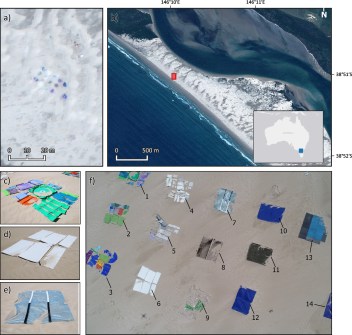
The BPDI is tailored to mapping plastic debris in beach environments using high-definition data from the WorldView-3 satellite.
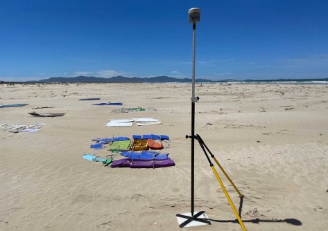
To test its performance, 14 plastic targets of around two square metres each were placed on a beach in southern Gippsland, Victoria.
Each target was made of a different type of plastic and was smaller than the satellite’s pixel size of about three square metres.
The satellite images analysed with the BPDI were compared with three existing indices, two of which were designed for detecting plastics on land and one for detecting plastics in aquatic settings.
The BPDI outperformed all three, with the others either struggling to differentiate plastic-contaminated pixels on the beach or tending to mis-classify shadow and water as plastic.
It is estimated that by 2030, 60 million tonnes of plastic rubbish will enter our oceans every year.
Study co-author, Dr Mariela Soto-Berelov, said the enhanced separability of the BPDI against water, in addition to sand, suggests its utility is superior in environments where water pixels and plastic-contaminated pixels are likely to coexist.
“This is incredibly exciting, as up to now we have not had a tool for detecting plastics in coastal environments from space,” she said.
“The beauty of satellite imagery is that it can capture large and remote areas at regular intervals.
Soto-Berelov said the next step is to test the BPDI’s utility in real life scenarios.
“We’re looking to partner with organisations on the next step of this research; this is a chance to help us protect delicate beaches from plastic waste,” she said.
Dr Guffogg led the study as part of her joint PhD research at RMIT in Australia and University of Twente in the Netherlands, and was supported by an Australian Government Research Training Program (RTP) scholarship. She now works in the geospatial mapping industry.


