


Flinders University coastal experts are finding more cost-efficient ways to capture crucial seascape bathymetric elevation data, through research projects that are monitoring environmental change across areas of South Australia’s coastline.
“High-precision traditional technologies such as topographic profiling, boat-based echo sounders and sonar are currently the best available methods for providing accurate bathymetric data, but their use can be limited by cost and time restraints,” says Professor Patrick Hesp, head of Environmental Science at Flinders University’s College of Science and Engineering.
Using satellite-derived bathymetry (SDB) method — a less-costly and highly efficient tool for researchers examining the movement of sand in the nearshore — the new study highlights the enhanced accuracy of optical satellite-derived bathymetric datasets in a shallow, low-wave-energy coastal environment by identifying the best combination of input satellite imagery, spectral bands and empirical derivation techniques.
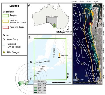
The research, which ties into the monitoring of seagrass movement and coastal impact studies across Adelaide and South Australia, uses optical satellite observations that are cost-effective, less intrusive than traditional methods, and capable of extensive coverage… which is especially helpful in remote locations.
“Our findings indicate that using satellite derived bathymetry improves the monitoring of seabed changes, which will improve our ability to map and monitor the dynamic sea floor and aid coastal management,” says Joram Downes, a student who recently completed his First-Class Honours thesis in the Beach and Dune Systems (BEADs) Laboratory at Flinders University.
Downes is lead author of a study that enhances the accuracy of optical satellite-derived bathymetric datasets for the Adelaide metropolitan coast by identifying the optimal combination of input satellite imagery, spectral bands, and empirical derivation techniques.
“Satellite derived bathymetry will supplement existing methods of data collection, filling in gaps in data where seafloor elevation remains unknown” says Associate Professor David Bruce, an expert in remote sensing at Flinders University, and primary supervisor of Mr Downes.
The study, part-funded by the Coast Protection Board, examined combinations of more than 100 bathymetric derivations that were calibrated and validated using more than 1 million ground observations. The results revealed an optimised method, achieving the best results with input spectral bands from the low-cost PlanetScope SuperDove constellation.
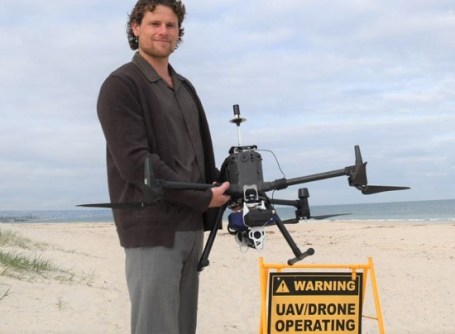
The research was also supported by the use of a newly acquired drone-based bathymetric LiDAR.
Flinders University’s Associate Professor Graziela Miot da Silva works with these systems in her scientific coastal surveillance projects and is delighted by the outcomes of this research.
“It was exciting to see these technologies working seamlessly together, especially the LiDAR that captured excellent data in shallow waters which closely aligned with the sonar dataset, and provided a precision method to correlate with the satellite-based bathymetry,” says Associate Professor Miot da Silva.
“This research not only optimises satellite derived bathymetry for use in the Gulf St Vincent, but it also provides valuable insights into how the number of input bands, their spatial resolution and their specific spectral properties influence the quality of satellite-derived bathymetry datasets,” says Mr Downes.
The research — “Optimising Satellite-Derived Bathymetry Using Optical Imagery over the Adelaide Metropolitan Coast”, by Joram Downes, David Bruce, Graziela Miot da Silva and Patrick Hesp — has been published in Remote Sensing.


