Guardian Australia reports that as of 8 January 2020, the total area burned across NSW, Victoria, Queensland, South Australia, Western Australia and Tasmania has now reached 8.4m hectares – an area larger than Scotland. At least 25 people have been killed, including three volunteer firefighters, and thousands of homes destroyed.
In addition to the ongoing fire-fighting effort, discussion is now beginning on recovery and rebuilding, an activity in which the spatial industry will play a very important role.
Recognising the urgent need for surveying to begin the recovery effort and a likely lag in the clarification of funding available, 3D-mapping and data analytics company Propeller Aero has taken to social media to offer its services to affected communities at no cost:
We are extending our offer to cover the entire country. If you’re located anywhere in Australia and need to survey a bushfire affected area we’d like to provide our photogrammetry processing services to you at no cost.https://t.co/018XuRgWkY
— Propeller Aero (@PropellerAero) January 6, 2020
The company said it will provide photogrammetry processing services at no cost, to anyone who needs to survey an area affected by bushfire. More information on the offer can be found here.
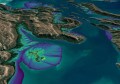
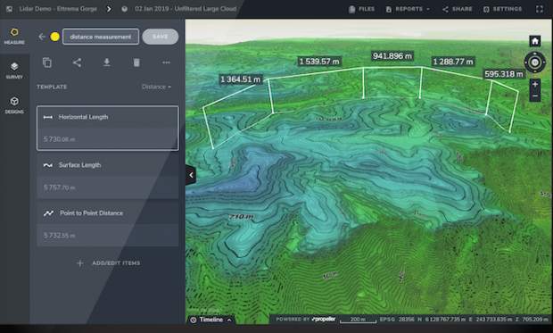
Propeller Aero doesn’t fly or supply the drones, but will take the supplied vision in the following formats: DXF, DWG, KML, and KMZ, and preprocessed data in LAZ/LAS and geoTiff, and will process it and create an accurate 3D terrain model of the fire ground for the user from that data. This model can then be viewed, shared with others, and measured (surface areas, distances, volumes, and slope angles).
Here are some ways that this could be helpful:
- Produce a 3D terrain model of the affected area, which can be easily shared with various parties, i.e. RFS/CFA, government, national parks, insurance, etc.
- Perform a visual inspection of the fire ground with the ability to zoom in/out and see how it all sits in with the existing satellite base maps.
- Perform measurements (distance, volume, area, cross sections, etc.) to determine loss of vegetation, habitats, infrastructure, etc.
- Mapping for firebreak construction.
- Mapping contours for rehabilitation, especially around townships.
- With fires also come runoffs. By using the terrain model to map the contours, users can predict what waterways will be affected when the rain does finally come.
If you are, or you know of, a person or company involved in bushfire-related spatial services please contact us at SpatialSource: info@52.64.66.132.