

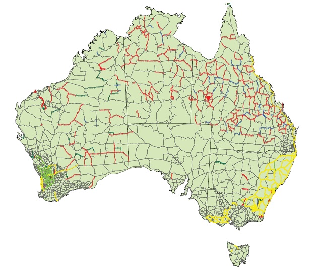
The ANLN, showing first-order levelling sections (yellow), second-order sections (light green), third-order (fine grey), fourth-order (dark green), one-way third-order (red) and two-way levelling of undefined quality (blue). Courtesy of Mick Filmer, Curtin University.
Over the end-of-year period, we’ll be reprising some of the best of the articles we’ve published over the past 12 months. We hope you enjoy catching up on what was making news in 2021.
The Australian Height Datum celebrates its half-century in 2021. We take a look back at how it all came about.
By Volker Janssen and Simon McElroy
In an increasingly digitised world, applications for the Australian Height Datum (AHD) are growing rapidly and reaching a wider audience with an insatiable appetite for three-dimensional digital twins of the real world. Vertical datums define a reference for elevation and are essential for many applications relying on the flow of fluids.
As the AHD marks its 50th anniversary this year, it remains Australia’s first and only legal vertical datum. For most spatial professionals, the AHD has been ubiquitous for the entire duration of their careers, being the vertical datum of choice because it was the only one. This article is the first in a series that will celebrate the AHD’s golden jubilee, with a focus on NSW.
Surveyors typically work with two types of heights: ellipsoidal heights referred to the Geocentric Datum of Australia (GDA2020) and physical heights referred to the AHD. Both are available through the NSW Survey Control Information Management System (SCIMS), the state’s database containing approximately 250,000 survey marks on public record.
Where it all began
In NSW, the AHD replaced the Standard Datum, which had been in use for some 80 years and defined by the value of mean sea level (MSL) at the Fort Denison tide gauge, located on an island in Sydney Harbour and accessible via a survey plug that was installed in 1882 (and still exists) on the external wall of the former Department of Lands building in Sydney.
The AHD (sometimes referred to as AHD71) was partly funded through a special 1961 federal government program to support the search for oil in Australia, via levelling within and connections between the various sedimentary basins. In May 1971, it was adopted by the National Mapping Council as the datum to which all vertical control for mapping was to be referred.
The AHD was realised by setting MSL to zero at 30 tide gauges distributed along the coast of mainland Australia and adjusting 97,320 km of primary two-way spirit levelling across the country. MSL observations spanned three years for all but one tide gauge, with earlier data over four years used at Karumba in the Gulf of Carpentaria. A subsequent adjustment also included about 80,000 km of supplementary one-way and two-way spirit levelling, in addition to and dependent upon the primary levelling.
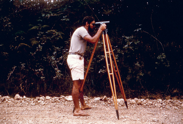
Levelling near Dorrigo, NSW in 1968–69. Courtesy of DCS Spatial Services.
For the first time, this provided a nationwide network of physical heights known as the Australian National Levelling Network (ANLN) — a stunning and quickly implemented achievement that required enormous effort. Prior to the AHD, many disconnected local height datums had been used in each Australian state and territory.
The question is naturally asked as to why third-order levelling was used for the primary survey. The short answer is that this practice was followed to produce the most useful outcome within the framework of funds and time available.
From that point of view, third-order levelling certainly provided an adequate basis for the topographic mapping program, general engineering purposes and the coordination of levelling surveys undertaken during gravity observations. Anything more was reportedly considered as “striving against the forces of nature in order to achieve an impossible dream”.
An important time consideration was that third-order levelling could be accomplished with readily available equipment and by available professional staff found in both the government and private sector. Of course, third-order levelling was also much cheaper than first-order and second-order levelling.
Considering the cost factor, as a rough rule of thumb, it was determined that an increase in a survey operation by a factor n involves an increase in time and funds of n2. Furthermore, even if better levelling standards had been adopted, this accuracy would have been swamped in the warping of the level surface to hold MSL equal to zero at the 30 tide gauges.
Practical realisation of AHD in NSW
On the ground, the AHD was realised by networks of approved survey marks. Some states organised their own ground marking and benefited as a result; others left it to contract surveyors. Typically, AHD marks were placed at intervals of one mile in regional areas and two miles in remote areas, usually following major roads.
The network was far denser in towns and cities. The separation was also varied to enable marks to be placed at easily identifiable locations (crossroads, property entrances, hill crests and bridges) in an era predating handheld GNSS positioning or even full mapping of the state. In many instances, ANLN marks were located close to existing road mile posts for easier retrieval.
Marking typically consisted of five State Survey Marks (SSMs, brass plaque in concrete) followed by a Permanent Mark (PM, usually employing a stainless-steel rod with concrete collar), with this pattern being repeated for the entire level run. Sometimes, pairs of PMs on opposite sides of the road were placed to provide extra redundancy.
Different level runs met and joined at junction points. Later, marking became more non-standard with entire runs sometimes consisting of only PMs or only SSMs and inter-station distances opting between miles or kilometres. Marks also varied with soil condition and where existing surveys were adopted or recycled.
Later, in the 1970s, NSW installed a series of Fundamental Bench Marks (FBMs) and Geodetic Bench Marks (GBMs). These were high-stability marks designed to physically hold and preserve AHD. Based on a European design, they were modified for Australian conditions, akin to trigonometrical (trig) stations for height.
FBMs and GBMs consisted of two to three marks installed in clusters, with the primary mark being located under a standard cover box. Marks consisted of stainless-steel rods driven to refusal in auger holes that were backfilled with sand to decouple the mark from any local soil movement. An extensive network of FBMs and GBMs was envisaged when construction began in 1973, but the program was abruptly terminated due to budget constraints.
While the AHD was designed as a third-order levelling network, NSW set a far higher standard. It supplemented, strengthened and improved the AHD by observing the nation’s most extensive and ambitious network of first-order levelling, which extended throughout the eastern part of the state.
While third-order levelling was performed by private sector contractors (whose participation was vital to the timely completion of the AHD), first-order levelling was conducted by the Central Mapping Authority (CMA), now DCS Spatial Services, a business unit of the NSW Department of Customer Service (DCS).
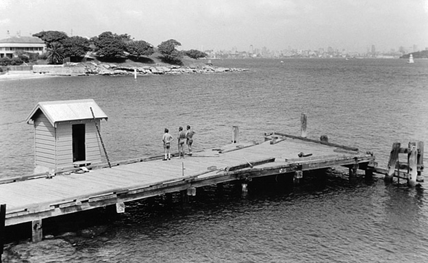
Camp Cove tide gauge in Sydney, showing the recorder hut housing a Harrison tide recorder. Courtesy of DCS Spatial Services.
Over the years, further level runs of various quality including one-way levelling were added to extend the network and investigate anomalies. An extensive capillary network of levelling to mountain-top trig stations was also established, typically one-way only, connecting to the nearest ANLN mark. To this day, discussions continue about the existence and nature of any systematic errors that may lie dormant in this then fit-for-purpose survey methodology.
For DCS Spatial Services, the era of optically (or digitally) observing extensive levelling networks ended well before the start of the 21st century, and in-house geodetic levelling subject matter experts have since retired. Today, the AHD is primarily derived from GNSS baseline networks, while digital levelling is only conducted for special projects, ad-hoc surveys or in some urban instances.
Adjustment of the ANLN
Prior to the adjustment, observed levelling data was corrected for the effect of non-parallelism of equipotential surfaces by applying the orthometric correction based on normal (modelled) gravity, which approximates true gravity.
Orthometric corrections can be as large as several centimetres in mountainous regions where the level surfaces exhibit steeper slopes than in lowlands, for example 309mm correction for the 146km level run from Adaminaby into the Snowy Mountains versus 33mm correction for the 155km level run between Dubbo and Forbes.
The AHD is considered a normal-orthometric height datum because existing gravity observations were insufficient. Instead, a truncated normal-orthometric correction was applied to the spirit levelling observations, which only utilised normal gravity (referenced to the GRS67 ellipsoid approximating the Earth).
The network of level sections and junction points was constrained at 30 tide gauges, which were assigned an AHD height of zero. In NSW, this included the tide gauges at Coffs Harbour, Sydney’s Camp Cove and Port Kembla, while Eden was excluded at the request of the Victorian and NSW Surveyors-General due to poor data.
The selection of Camp Cove (established in 1916) over Fort Denison — the second continuously recording tide gauge established in Australia in 1886 with records dating back even further and a long association with levelling datums — was attributed to the difficulty in making the cross-water connection (about 600 m between the island and Mrs Macquarie’s Point) and the existence of a tidal gradient between the entrance to Sydney Harbour and Fort Denison. While there were many interruptions to the national tide gauge network recordings due to theft, vandalism and faulty gauges, acceptable results were obtained from the 30 gauges eventually chosen.
The least squares adjustment propagated MSL heights, or AHD heights, across the levelling network. This adjustment occurred in two phases due to the computational limits of the impressive CDC 3600 computer used at the time. In phase 1, five regional adjustments were made within boundaries approximating state limits (WA, SA and NT, QLD, NSW, VIC).
In phase 2, these were combined to produce two solutions: a minimally constrained solution with one station held fixed to assess the quality of the levelling, and the final adjustment constrained to the 30 tide gauges (run on 5 May 1971).
The minimally constrained solution indicated a standard deviation of about 0.3 m in the centre of Australia. Despite the best efforts of surveyors, gross, random and systematic errors crept into the level sections and were distributed across the network within the adjustment.
The average loop closure was ±6 mm/√km but the loop closures did not conform to a normal distribution. The average correction applied to the regional adjustments was ±3 mm/√km. An assessment of the standard weight of the minimally constrained adjustment was ±7 mm/√km for all states but NSW.
Detailed analysis indicated that the data for the south-eastern corner of NSW was statistically inferior despite the existence of mostly first-order levelling. Reportedly, this indicated that, after several years, first-order surveys tend to deteriorate to much the same order of accuracy as third-order levelling.
Lord Howe Island and Norfolk Island are not covered by the AHD and continue to use local historical height datums, the origins of which require more detailed investigation, documentation and public communication.
As an aside, the Tasmanian AHD (often referred to as AHD-TAS83 or AHD83) was realised separately by setting MSL observations for only one whole year (1972) to zero at the tide gauges in Hobart and Burnie. It was propagated using mostly third-order levelling over 72 sections between 57 junction points and adjusted on 17 October 1983.
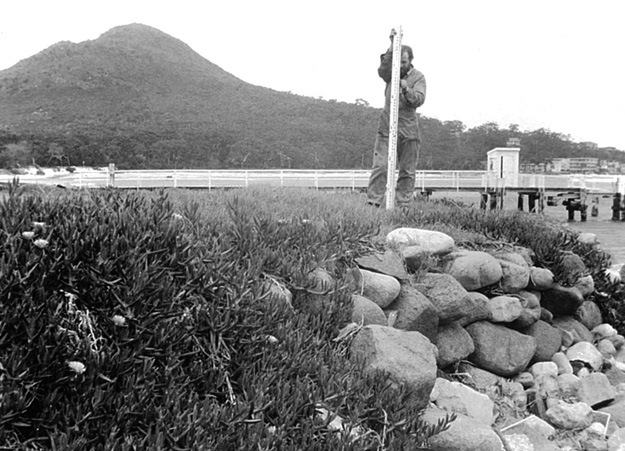
Levelling at the Port Stephens, NSW, tide gauge. Courtesy of DCS Spatial Services.
Shortcomings of AHD
Over time, significant and well-documented shortcomings in the AHD realisation became apparent. In short, due to dynamic ocean effects (including winds, currents, atmospheric pressure, temperature and salinity), tide gauge observations spanning only a period of three years and the omission of observed gravity, MSL was not coincident with the geoid at the tide gauge locations.
The primary bias is due to the AHD realisation ignoring the effect of the ocean’s time-mean dynamic topography, resulting in the AHD being about 0.5 m above the geoid in north-east Australia and about 0.5 m below the geoid in south-west Australia. Together with uncorrected levelling errors, this introduced considerable distortions of up to about 1.5 m into AHD across Australia.
Observational blunders included those caused by observing in imperial units, where a whole foot was easily dropped or picked up. Random errors included those caused by metrification in Australia, having to use metres in calculations although the data was observed in feet.
However, there were also downright fraudulent level runs, including the fable of the contractor who supposedly adjusted out a misclose of more than seven feet while enjoying a cold beer at a pub in Tibooburra. The independent approach of a few surveyors who did not fully conform to the prescribed specifications also caused issues.
Despite all this, the AHD has, overall, continued to be a practical height datum that is fit for purpose, providing a sufficient robustness for many surveying and engineering applications, particularly over smaller areas (less than 10 km).
A new age is dawning
The AHD remains Australia’s first and only legal vertical datum. It has been a stalwart of Australian surveying, replacing a collection of various local vertical datums and the then 80-year old Standard Datum, and successfully satisfied users ranging from mums and dads to engineers and geodesists for 50 years.
The establishment and survey of the ANLN has been a stunning and quickly implemented achievement that required enormous effort. However, the AHD is beginning to show its age, particularly over larger areas and for users of modern positioning technology.
In this article, we have helped celebrate the AHD’s the golden jubilee by outlining its history, achievements and longevity, while also noting its shortcomings. In upcoming articles we will look ahead to a new era of vertical datum determination and describe the datum maintenance efforts undertaken in NSW.
Dr Volker Janssen and Simon McElroy work at DCS Spatial Services, a unit of the NSW Department of Customer Service.
This article was first published in issue 113 of Position magazine.
Stay up to date by getting stories like this delivered to your inbox.
Sign up to receive our free weekly Spatial Source newsletter.


