

An early interest in maps and geography has led to an award-winning career as a GIS professional and drone pilot.
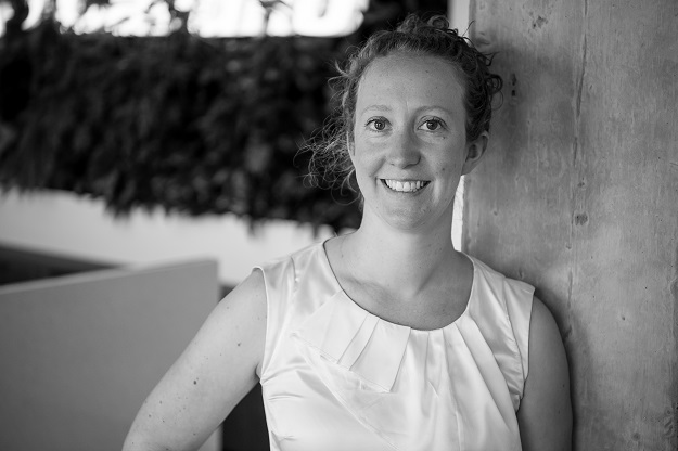
Amy Steiger is a GIS Manager and Data Acquisition Lead with Cardno, an international infrastructure, environmental and social development company that operates in more than 100 countries. She has been recognised for her work with a Special Achievement Award from the SSSI in 2019, and an Industry Champion Award from the Australian Association for Unmanned Systems in 2020.
Steiger, who is based in Wollongong in NSW, spoke to us about her career and the challenges and opportunities for professionals in this field.
Position: Please tell us what your job involves.
AS: I’ve been with Cardno since I was a graduate and now lead a team of GIS professionals from our Wollongong office. I’m also one of our qualified drone pilots. For the last year I’ve been the APAC lead for our Data Acquisition Centre of Excellence, which means assisting our surveyors and field staff, plus looking for new ways to apply drones, ROVs, laser scanners and satellite imagery in our business.
Position: How did you get into this line of work?
AS: I’ve always had an interest in maps and geography. It was that and a passion for the outdoors got me into the spatial science world. I studied at university, but so much of the spatial skills I have learned to apply are those that you learn being on the tools day in and day out. My career has been a steady progression of being open to try new things, saying yes and putting my hand up for presentations and conferences. I happened to have some training budget to spend when our surveyors got into drones back in 2013–14, so I jumped on board with what they were doing and got my remote pilot license with the hope that I could get out of the office a little bit more.
Position: Tell us about the post-fires wildlife work you were involved in. How were you able to contribute?
AS: I’m a volunteer with the NSW State Emergency Service (SES), and I was able to spend a few days on deployment on the map desk in the Nowra Fire Control Centre towards the end of the Currowan Fire. And, through Cardno, we were able to mobilise a team of ecologists, spatial professionals and drone pilots to assist a wildlife sanctuary near Bendalong. We used a thermal camera to try to identify refuges where wildlife might be hiding.
One thing we didn’t consider was that there would still be hot logs and rocks one month on from when the fires had come past! Despite this we were able to help the property owners get a handle of the scale of impact on their property, hear their experiences and drop off some food for the wildlife.
Position: You do a lot of coastal work, including cliffs. Is this particularly challenging?
AS: Yes! I always seem to end up flying on the coast. I’ve done some beach surveys around Port Phillip Bay, cliff stability inspections in coastal national parks and most recently some work near Sea Cliff Bridge in NSW. I don’t know if people realise quite how heart-racing flying a drone can be, when you’re avoiding sea eagles, flying over bodies of water, judging the height of a cliff and managing battery levels. It can be nice to have the drone back on the ground sometimes!
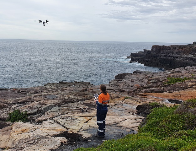
Coastal cliff hazard mapping at Ben Boyd National Park at Eden, NSW.
Position: What’s another interesting or fulfilling project you’ve worked on recently?
AS: It’s been exciting to work with our drone teams in New Zealand over the last 18 months. They’re using thermal cameras to identify potential leaks in water networks, helping to save inspection time, money and water.
Position: Is there a lot of variety in your work?
AS: Absolutely! The spatial industry is always full of variety and more so with my data acquisition role, learning more about ROVs and space-based data acquisition as it makes a comeback. Every day is different with a new discipline or challenge where GIS can be applied.
Position: What sort of technological change have you seen in remotely piloted aircraft?
AS: Better sensors and longer flight time are the big ones for me. An RPA is really only as good as the sensor it carries; being able to swap different sensors in and out or fly with multiple sensors is really exciting and saves time by flying once.
Surveyors might say parts of their job have become easier (flying stockpiles instead of climbing up them), but for me I think it’s become more diverse — we’re doing things that we wouldn’t have done before, such as being able to capture our own orthophotos on demand, or changing our approach for something that could have been cost prohibitive or dangerous, like cliff inspections on-rope.
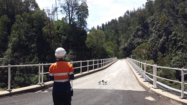
Hazard mapping for Snowy Hydro along a road near Cabramurra, NSW.
Position: What’s coming next in RPAs that you can’t wait to see?
AS: It can be a difficult industry to keep on top of — legislation is always being tweaked and new technology means that equipment doesn’t stay the latest model for long. It’s hard to know what will be next. But the things I’m trying to keeping tabs on for now are airborne/shallow water LiDAR, EVLOS (extended visual line of sight) and BVLOS (beyond visual line of sight).
Don’t forget that in Australia, CASA drone registration and RePL /operator accreditation is now mandatory for everyone if you’re flying for work.
Position: What advice do you have for others in the geospatial industry?
AS: My daughter is nearly four and the job she may have in the future might not even exist yet, so it’s a pretty exciting time to be in the geospatial industry. But we need to try to be flexible, adaptable and open to new technology. We should not be afraid to be a little innovative or challenge the way we have always done something.
This article was first published in issue 113 of Position magazine.
Stay up to date by getting stories like this delivered to your inbox.
Sign up to receive our free weekly Spatial Source newsletter.


