

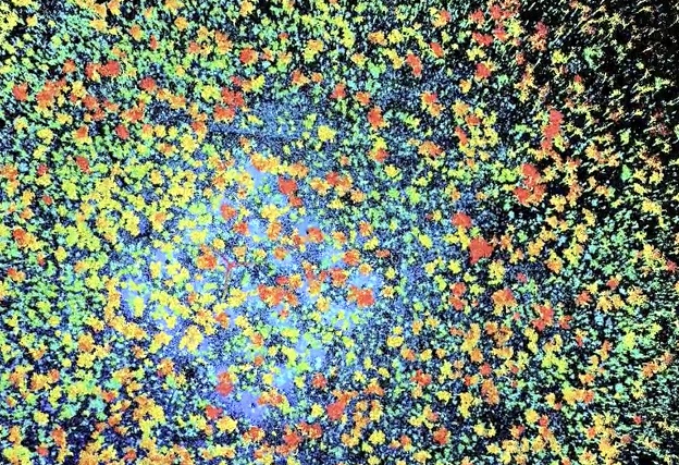
An overhead ‘virtual forest’ view of TERN’s Litchfield Savanna SuperSite. All images courtesy TERN.
The ability of the world’s space agencies to deliver verifiable satellite imagery data is reliant on reference data collected on-ground at sites such as the Terrestrial Ecosystem Research Network’s (TERN, tern.org.au) Litchfield Savanna SuperSite in the Northern Territory.
One of the world’s most important environmental monitoring sites, TERN’s Litchfield field station supports global satellite environmental monitoring programs and is considered critical in ensuring that world-wide data products are accurate and reliable for Australia and beyond.
Satellite imagery is used in many applications ranging from daily weather prediction to supporting agricultural production, biosecurity and environmental monitoring. For Australia’s environmental monitoring responsibilities alone, which extend well beyond the Australian land mass to its oceans and outlying territories, information often can only be cost-effectively gathered by using satellites.
The world’s satellite data are reliant on on-the-ground data collected by agencies such as TERN and its analogous environmental observatories around the world. Field data are used to validate that the information coming from satellites is an accurate representation of what’s happening on the ground.

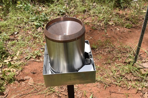
Stefan Maier undertaking maintenance of the automatic, hemispherical, digital cameras used for measuring vegetation cover and leaf area index. A metal heat shield has been added for protection from bushfires.
Data from TERN’s ecosystem field observatory — including plot data on soil and vegetation; gas, energy, and water exchange data; remote sensing data; and modelled data products about soil, climate, and landscape attributes — are being used on the international stage by Europe’s, the USA’s and India’s space agencies to improve the accuracy of global biogeophysical satellite products.
This article will give an overview of one of TERN’s world’s leading monitoring field stations, showing the ways in which ecosystem observation data are ensuring the accuracy of some of the planet’s most important environmental monitoring tools.
A global Earth observation superstar
At the forefront of TERN and Australia’s global satellite data calibration and validation activities is TERN’s Litchfield Savanna SuperSite in the Northern Territory. Thanks to significant investment from NCRIS-enabled TERN, international space agencies and site partners, it has quickly shot to global stardom to become one of the world’s most important environmental monitoring sites.
Investment in TERN by the European Commission through the Copernicus Global Land Service’s Ground-Based Observations for Validation (GBOV) component, has enabled the installation of a suite of new environmental monitoring instruments on the site’s 40-metre-tall eddy-covariance flux tower and on the ground.
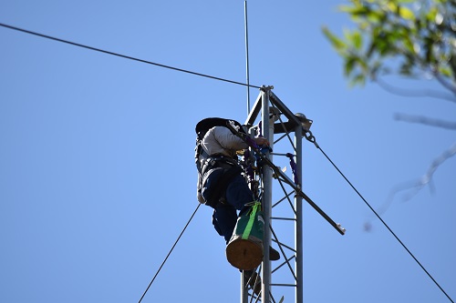
Matt Northwood installing Photosynthetic Active Radiation sensors on the Litchfield Savanna SuperSite instrument tower. Sensors are measuring down- and up-welling PAR for estimating the fraction of absorbed photosynthetic active radiation.
The data collected will improve the scalability and accuracy of seven satellite-derived data products, including five Essential Climate Variables, which critically contribute to the characterisation of Earth’s climate as outlined by the World Meteorological Organisation:
- Surface reflectance
- Surface albedo
- Soil moisture
- Leaf area index (LAI)
- Fraction of absorbed photosynthetically active radiation (FAPAR)
- Fraction of covered land (FCOVER)
- Land surface temperature (LST)
All this amounts to an impressive new capability that not only measures the dynamics of this savanna ecosystem in greater detail, but also helps to verify the accuracy of a number of globally important satellite imagery products delivered by the European Commission’s Copernicus Global Land Service and the European Space Agency through their Sentinel missions.
“With this instrument set, the Litchfield SuperSite is now the second monitoring site in the Southern Hemisphere capable of providing ground reference measurements for the seven key products delivered by the Copernicus Global Land Service, making Litchfield a first-class validation site,” said Dr Christophe Lerebourg, Copernicus Global Land Service’s Ground-Based Observations for Validation (GBOV) service manager at ACRI-ST. TERN’s Tumbarumba Wet Eucalypt SuperSite was the first such site.
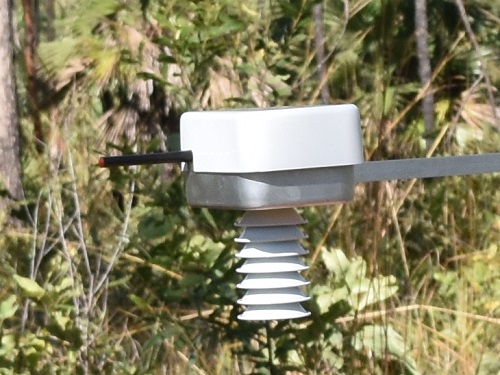
Air temperature and humidity sensor.
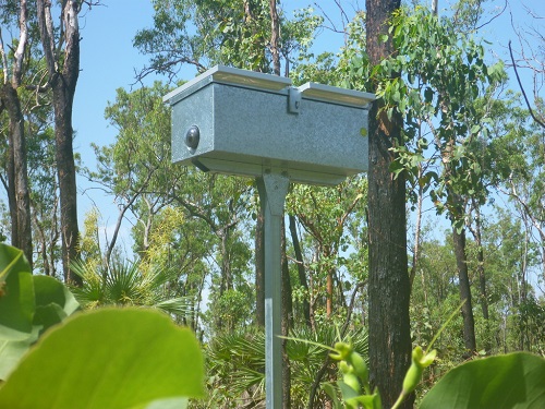
An automatic camera (with standard and fish-eye lenses) to capture images of the canopy for estimating cover and leaf area index.
According to Lerebourg, Litchfield and TERN’s Tumbarumba Wet Eucalypt SuperSite (the first such site in the Southern Hemisphere) are the only monitoring sites with long-term instrumentation dedicated to vegetation monitoring. He said that among the seven core GBOV products, vegetation variables like LAI, FAPAR and FCOVER are indeed the most difficult to monitor on a regular basis.
“In addition, woody savannas are poorly represented worldwide in our Cal/Val dataset. This makes Litchfield an even more valuable ground site. A very important point with TERN ground sites is that they generally offer a large spatial homogeneity compared to European sites. This is a great advantage when validating Earth Observation data,” said Lerebourg.
“It’s quite common for satellite products developed using Northern Hemisphere sites to misrepresent Australian conditions, so this is a major breakthrough for Australian and global science.
“TERN is clearly a first-class candidate for Earth Observation product Cal/Val. It is supported by highly qualified and motived scientists. We have collaborated with TERN for more than four years now. GBOV really appreciates TERN’s contribution to this Cal/Val effort and we are looking forward to strengthening our collaboration into the future,” added Lerebourg.
More accurate and representative data
TERN’s Litchfield Savanna SuperSite is located in Litchfield National Park about 80 kms south of Darwin. Average annual rainfall is about 1,900 mm, 90% of which falls between December and March.
It’s the site’s uniquely contrasting wet-dry season climate, variety of vegetation types, flat topography and relatively low cloud cover outside the monsoonal season that makes it a highly desired location for satellite data validation. Its proximity to the equator enables it to support satellite missions in polar and near-equatorial orbits.
The TERN SuperSite’s co-manager, Dr Stefan Maier of Maitec, says that when GBOV needed data representation in Southern Hemisphere tropical savanna ecosystems, the TERN site was their first choice.
“Our Europeans colleagues knew of the Litchfield site through long-standing collaborations and the Committee on Earth Observation Satellites (CEOS) ranking of 55 global research sites most suitable for international calibration validation activities, and spoke highly of TERN and Maitec as good collaborators. Stable governance and safe site access were also important considerations,” said Maier.
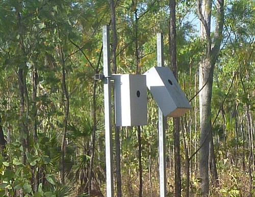
An automatic camera (with standard and fish-eye lenses) to capture images of the understory for estimating cover and leaf area index.
Rain gauge.
Soil probes measure soil moisture and temperature at 5 cm depth.
There are two main benefits of using Australian data for satellite products validation… especially data from the Litchfield Savanna SuperSite.
First, using Australian data for validation leads to better and more accurate satellite imagery product development for Australian conditions. And, second, a better representation of the Southern Hemisphere will significantly improve our capacity to validate satellite products on a global scale.
Ingenuity to overcome fire, heat and humidity
The site’s location and climate make it desirable for data collection, but it also presents some huge challenges, says Professor Lindsay Hutley, of TERN’s site partner Charles Darwin University.
“What works in in Europe, just doesn’t work in this harsh Australian environment. It gets much hotter and wetter so instrument enclosures rated as waterproof are not good enough in this environment, due to the extreme heat and humidity,” he said.
“The regular bushfires are the big challenge when installing sensitive monitoring equipment. We protect our instrumentation to make sure it can survive a fire, such as implementing cool, low-impact burns around infrastructure through to using metal enclosures instead of the usual plastic or fibreglass, or adding additional glass domes to the automatic cameras.
“The other thing we battle are termites and ants. They just love chewing through silicon seals and wiring, and nesting in the equipment; a logger box is like a five-star hotel!” he said.
“Equipment turnover is high, but a lot of work from our site manager Matthew Northwood goes into safeguarding this critical infrastructure and maintaining the data streams.”
Global vegetation health monitoring
Cutting-edge systems, developed in Australia for ground monitoring and deployed previously at the Tumbarumba SuperSite, have also caught the interest of the German Aerospace Centre (DLR).
DLR and Forschungszentrum Jülich (FZJ) are utilising the Litchfield Savanna SuperSite in a project monitoring the ‘solar-induced fluorescence’ emitted by plants in order to remotely monitor vegetation health.
DLR’s spaceborne sensors routinely measure fluorescence from space and use data collected by on-ground instruments to calibrate the outputs.
TERN’s Litchfield Savanna SuperSite, with its world-leading research infrastructure equipment, infrastructure operators and researcher users, is truly writing another page in Australia’s proud history in supporting some of the biggest space missions to monitor the planet’s environment.
Information supplied courtesy of TERN.
This article was first published in the Apr/May 2022 issue of Position magazine.
Stay up to date by getting stories like this delivered to your inbox.
Sign up to receive our free weekly Spatial Source newsletter.


